Location, Dorchester, WI
Only routine things for the last few days.
I finally had the propane tank filled. I had to go by the bulk propane store twice before I found someone there to help me. Small town businesses operate on their own schedule.
I also picked up the oil I need to get the oil changed in the truck tomorrow.
This morning I met and old high school buddy for breakfast. We both drove to Withee, WI, a half way point, and met at a local restaurant. An hour’s conversation caught us up on family, aches and pains, grandchildren, etc. During the conversation we realized that only 6 males remain from our high school graduating class. We have lost a lot of old school chums in the last few years. Only one female has died since we graduated.
At some time during each day we stop in Colby to see my mother. She enjoys an hour or so of conversation. They do keep them busy at assisted living but conversation is rather limited.
Tuesday, August 30, 2011
Sunday, August 28, 2011
Edgar steam and tractor show.
Location, Dorchester, WI
Today was the final day of the Edgar Steam and Tractor Show on a farm near Edgar, WI and what a show it was. Four years ago we attended this show and it has grown tremendously since then.
My brother Ray and I talked to the secretary for the organization which sponsors this great 3 day show. She said attendance has been running at 10,000 people a day with the show getting bigger each year. There were 800 tractors and 350 venders set up for the show as well as food venders, small hit and miss engine section, hundreds of people camping, and demonstrations of work done by small and large engines.
Clyda and I arrived about 10 AM and watched a very large steam engine run an old fashioned saw mill. It drew quit a crowd. We watched a shingle mill cutting shingles, a crew sorting and banding the shingles, and a man branding shingles with the 2011 logo for the show.
There was silo filling, threshing using large steam engines and old stationary threshing machines. There was plowing with a large steam engine pulling an eight gang plow. It took 4 men on the plow to set the depth, three on the engine to run it, 300 plus gallons of water to provide steam, and lots of coal to keep the boiler fired up. One round of the field required another load of water before the next furrow could be turned.
There was a tractor parade which lasted about an hour and a half for all to pass by. Each tractor was announced and the drivers name given. Some were fully restored pristine tractors while others were working tractors. It was a great show!

That's one big tractor.

Look at the line up of steam engines!

Treshing, the old fasioned way.

Saturday, August 27, 2011
Update.
Location, Dorchester, WI
The last four days have gone by rather quickly.
On Wednesday we had a Care Conference for my father with the staff of the nursing home where he is. We got a report from each person who interfaces with Pa. Very professional.
His weight is up some but not terribly. They would like to keep his weight down as it is easier for 2 people to handle him. He is comfortable and well taken care of. The hardest part is his speech which is more of a mumble now. It is related to his dementia. He recognizes no on.
Ma on the other hand is doing as well as can be expected. She was in the hospital recently because she couldn’t get any air even with the oxygen she is on. That took a lot out of her. Just getting up to go to the bathroom tires her out. Between her lungs and her heart problems, one or the other will just give out one day.
We try to visit her each day although tomorrow we are going to the Steam and tractor Show at Edgar which is west of Wausau. We have been there before. Still fun to see all the old steam operated equipment and the refurbished tractors.
We have also connected with old school friends who live here. Went out to dinner last night with them and then played cards and games until 11:30 PM.
I need to get a bottle of propane filled but so far haven’t found anyplace to do that. Also, need to get the oil changed in the truck. Still looking for the kind of oil I use. Everything was closed this afternoon. Not used to that in California.
Tuesday, August 23, 2011
Arrived in Wisconsin.
Location, Dorchester, WI
We had a fairly severe storm at 4:30 this morning which included lightning, wind, lots of rain, and hail. By the time we got out of bed, there was little evidence of the storm.
We drove back roads today so we didn’t need to fight the traffic in and around Minneapolis. Our drive took us east on MN 95 to St Croix where we crossed the St Croix River to Wisconsin. The highway number changed to 8 but continued east. We intercepted Hwy 53 which runs south from Duluth to Eau Claire, and drove it to Eau Claire where we switched to Hwy 29 which goes east to Green Bay. We got off 29 in Abbotsford which is “Wisconsin’s first city” according to the sign as you enter town.
I was concerned that the City RV Park in Dorchester would be full with the coming Labor Day weekend as there are only a few sites with full hook ups. Not to worry, as only 3 of the spaces were occupied.
We had been watching a slow moving storm north of us as we traveled and were glad to get to the park before it rained. Within 3 hours after we arrived we had 3 shorts storms, the last one very intensive. The TV said the last storm spawned a small tornado south of here.
Monday, August 22, 2011
Traveling through Minnesota.
Location, St Cloud, MN
We are in St Cloud, Minnesota at the St Cloud RV Park which is east of town. It is a really nice RV Park in a park like setting. Wish we were going to be here more than one night.
Most of the RV Parks we have stayed at since we headed east have lots of workers living in them. Further west there were combine crews harvesting wheat, in North Dakota there were oil field workers and highway crews working on the interstate. Here, there is a painting crew whose expertise is spray painting. What they paint is anybody’s guess.
Corn field, our view out the window for most of the day.
 So far the weather has been great with temps in the 80’s and no rain. That may be about to change overnight as the sky to the west was dark late this afternoon.
We are going to take secondary roads from St Cloud to Wisconsin tomorrow as I don’t want to travel through Minneapolis. We will travel on some interstate highways after we get to Wisconsin.
We are in St Cloud, Minnesota at the St Cloud RV Park which is east of town. It is a really nice RV Park in a park like setting. Wish we were going to be here more than one night.
Most of the RV Parks we have stayed at since we headed east have lots of workers living in them. Further west there were combine crews harvesting wheat, in North Dakota there were oil field workers and highway crews working on the interstate. Here, there is a painting crew whose expertise is spray painting. What they paint is anybody’s guess.
Corn field, our view out the window for most of the day.

We are going to take secondary roads from St Cloud to Wisconsin tomorrow as I don’t want to travel through Minneapolis. We will travel on some interstate highways after we get to Wisconsin.
Sunday, August 21, 2011
Moving east.
Location, Jamestown, ND
Note: I have added a few photos to the August 18th entry.
A somewhat shorter drive today of 290 miles from Glendive, MT to Jamestown, ND.
We are camped at Frontier RV Park which is next to Frontier Village, a pseudo old western town with a statue of a buffalo claimed to be the biggest in the world. There are also wild buffalos nearby including an albino female.

The only point of interest is a cabin claimed to be the “writing cabin” of Louis L’Amour who is a native of Jamestown.
We also saw a statue of the world’s biggest Holstein cow.

Once we left Montana there weren’t as many hills on the highway so I could use the cruise control more. This helps my sciatic nerve in my right hip from flaring up. Of course we crossed into Central Daylight Time so we lost an hour. It just means I can go to bed an hour earlier.
Clyda tried to get a photo of all the hay bales in the fields along the highway. This is the best she could do.

My GPS quit after we arrived here. I turned it off when we arrived and attempted to turn it on later when we drove into town but it is dead. I sent Magellan an email asking for help. We’ll see what happens. Heavens, I may need to refer to paper maps for the rest of the trip!
Saturday, August 20, 2011
Driving across Montana
Location, Glendive, MT
Yesterday’s drive was from Great Falls to Bozeman, MT.
I had planned to camp on the east side of town but the campground was full so we had to go to the KOA west of town. Of course, it cost a fortune, but in retrospect, it saved us a good 20 mile trip to see our friends who live within 5 minutes of the KOA.
We talked for several hours on the patio then went out for dinner at a very good Italian restaurant. After dinner we got the tour of Bozeman which is a very nice town. There has been a lot of building since we were there several years ago.
Our plans have changed. We now are driving east on I-94 headed for Wisconsin. My mother is not doing well so we decided we need to interrupt our trip and go to Wisconsin.
We are stopped for the night in Glendive, MT which is near the North Dakota border. Today was a long day of driving, all of it along the Yellowstone River which grows in size as smaller rivers join it.
We are through the mountains and in the high plains now. There is lots of wheat which is being harvested now as well as occasional fields of corn.
It will take us 3 more days of driving but not at today’s pace to get there.
Thursday, August 18, 2011
Lewis and Clark.
Location, Great Falls, MT
Late yesterday a fire broke out north of us. The smoke drifted in our direction so it was bad for a while. They must have the fire out as we had no smoke this morning.
Today we drove north and east of the city to the Great Falls which is dammed by Ryan Dam but still is impressive.


Combines are working in the fields north of the river which Meriwether Lewis described as “teaming with buffalo” when he first saw this land.

That was our next stop, the Lewis and Clark Interpretive Center east of town along the Missouri River. We spent several hours here watching movies, listening to lectures, and viewing the incredible displays. This center is 13 years old and well worth a stop for Lewis and Clark aficionados.

We finished the day with shopping at Wal-Mart. Clyda got a haircut and then we refilled the larder. Exciting!!!
Late yesterday a fire broke out north of us. The smoke drifted in our direction so it was bad for a while. They must have the fire out as we had no smoke this morning.
Today we drove north and east of the city to the Great Falls which is dammed by Ryan Dam but still is impressive.

Foot bridge over the power house outfall.


Combines are working in the fields north of the river which Meriwether Lewis described as “teaming with buffalo” when he first saw this land.

That was our next stop, the Lewis and Clark Interpretive Center east of town along the Missouri River. We spent several hours here watching movies, listening to lectures, and viewing the incredible displays. This center is 13 years old and well worth a stop for Lewis and Clark aficionados.

We finished the day with shopping at Wal-Mart. Clyda got a haircut and then we refilled the larder. Exciting!!!
Wednesday, August 17, 2011
Oh Canada! and Bears, Bears, Bears!!
Location, Great Falls, MT
Yesterday we all got out of bed early for a day in Waterton-Glacier National Park in Canada. We had two vehicles for the 10 of us. After a short drive, we crossed the border into Canada without problems.

On the way to the park headquarters we saw cars parked along the road. They were watching a black bear feeding behind some bushes a couple hundred yards away. Shortly after we stopped the bear ambled over the ridge.

We drove to the Village and walked around looking at the shops which were just opening. We took pictures of the flower gardens which were protected from the deer with tall wire fences.
We next stopped at the Prince of Wales Hotel. This is an impressive building built in the early 1900’s. We then drove to the end of the road at Red Rock and had a light lunch which we brought with us. After lunch we walked along the Red Rock canyon which is cut in the native rock.


On the way back to the village we stopped at several lookout spots to check out the impressive scenery.
Again we stopped as cars were parked along the road while a mother black bear and 2 cubs crossed the road. We got some great photos. We also saw 2 other bears grazing along the ridge as we drove by. These were browner looking but still considered black bears.


As we left the park I saw a large black bear crossing the river but he was too far away for photos.
We again crossed back through the border and drove to Many Glaciers Canyon north of St Mary. We all decided that ice cream was in order so we stopped at a small shop at roads end. When we got out of the trucks, a ranger had a large pair of binoculars pointed up the mountain which he was using to track two mountain goats grazing on the hill side. We all got a look at them through the binoculars. They were visible to the naked eye, just barely.
Today, we went our separate ways. One couple drove back to Canada this morning to visit Banff and Lake Louise for a few days, three couples headed west to Washington, while Clyda and I drove east to Cutbank, MT then south to Great Falls, MT. Cutbank is the coldest place in the USA most winter days.
We are staying at Dick’s RV Park for 2 days. Fortunately I called them while we were on the road for a reservation. I think they are full tonight. Lots of combine crews in the park as it is full on wheat harvest time in Montana.
This afternoon was laundry time a dreaded chore at anytime.
Something I haven’t mentioned, the weather around Glacier National Park. For the first week while we were at West Glacier the weather was beautiful with warm days and nights. When we moved to the east side at St Mary it was cooler with lots of wind and the wind has continued to blow. Just part of Montana!
Yesterday we all got out of bed early for a day in Waterton-Glacier National Park in Canada. We had two vehicles for the 10 of us. After a short drive, we crossed the border into Canada without problems.

On the way to the park headquarters we saw cars parked along the road. They were watching a black bear feeding behind some bushes a couple hundred yards away. Shortly after we stopped the bear ambled over the ridge.

We drove to the Village and walked around looking at the shops which were just opening. We took pictures of the flower gardens which were protected from the deer with tall wire fences.
We next stopped at the Prince of Wales Hotel. This is an impressive building built in the early 1900’s. We then drove to the end of the road at Red Rock and had a light lunch which we brought with us. After lunch we walked along the Red Rock canyon which is cut in the native rock.


Relaxing in luxury at the Prince of Wales Hotel.

On the way back to the village we stopped at several lookout spots to check out the impressive scenery.
Again we stopped as cars were parked along the road while a mother black bear and 2 cubs crossed the road. We got some great photos. We also saw 2 other bears grazing along the ridge as we drove by. These were browner looking but still considered black bears.


As we left the park I saw a large black bear crossing the river but he was too far away for photos.
We again crossed back through the border and drove to Many Glaciers Canyon north of St Mary. We all decided that ice cream was in order so we stopped at a small shop at roads end. When we got out of the trucks, a ranger had a large pair of binoculars pointed up the mountain which he was using to track two mountain goats grazing on the hill side. We all got a look at them through the binoculars. They were visible to the naked eye, just barely.
Today, we went our separate ways. One couple drove back to Canada this morning to visit Banff and Lake Louise for a few days, three couples headed west to Washington, while Clyda and I drove east to Cutbank, MT then south to Great Falls, MT. Cutbank is the coldest place in the USA most winter days.
We are staying at Dick’s RV Park for 2 days. Fortunately I called them while we were on the road for a reservation. I think they are full tonight. Lots of combine crews in the park as it is full on wheat harvest time in Montana.
This afternoon was laundry time a dreaded chore at anytime.
Something I haven’t mentioned, the weather around Glacier National Park. For the first week while we were at West Glacier the weather was beautiful with warm days and nights. When we moved to the east side at St Mary it was cooler with lots of wind and the wind has continued to blow. Just part of Montana!
Monday, August 15, 2011
Moving day.
Location, St Mary, MT
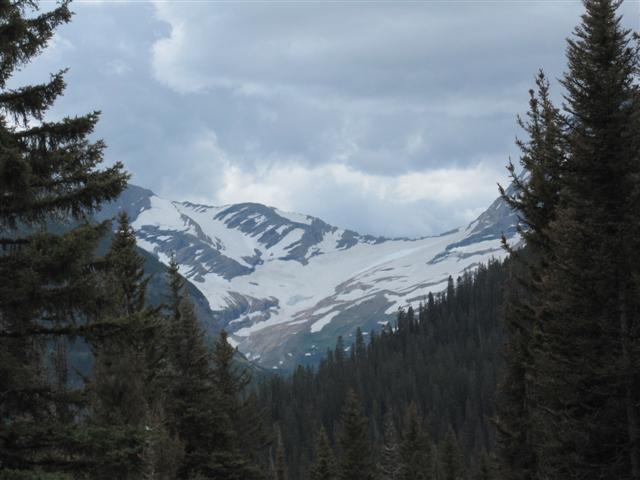
Today we moved to the east side of Glacier National Park to the town of St Mary. Not much of a town really but it is the east entrance to the park and “Going to the Sun” road.
On the road to St Mary with Glacier National Park mountains in the distance.


While driving between Essex and Browning we came upon 2 cars pulled off of the road, sort of. As we pulled out to pass we noticed that one of the drivers had a camera pointed out of his window toward the left side of the road. At first I didn’t see what he was shooting” but as I glance upward I saw a grizzly bear on the ridge above the road eating grass. It defiantly was a grizzly even though a few of us saw it.
Stopped in Browning n the way to St Mary.

We planned to go on a tour on one of the neat Red Car’s on Wednesday and go to Waterton-Glacier National Park in Canada however all seats were booked for both Tuesday and Wednesday. So, I guess, no Red Car tour this time. Too bad as it really would have been neat.
So, instead we drove the “Going to the Sun road” part way today and looked at all the water falls and stopped at an overlook to see the Jackson Glacier. It is the only glacier visible from any of the roads in the Park. Of the original 130 glaciers in the park, only 25 still remain. It is estimated that all glaciers will be gone within 10 years. I am glad we did the trip this year.
Sun Rift Gorge in the background.


We do plan to drive to Wateron-Glacier National Park in Canada tomorrow. It is only 20 miles to the border from here and about an hour into the main part of the part.
Today we moved to the east side of Glacier National Park to the town of St Mary. Not much of a town really but it is the east entrance to the park and “Going to the Sun” road.
On the road to St Mary with Glacier National Park mountains in the distance.


While driving between Essex and Browning we came upon 2 cars pulled off of the road, sort of. As we pulled out to pass we noticed that one of the drivers had a camera pointed out of his window toward the left side of the road. At first I didn’t see what he was shooting” but as I glance upward I saw a grizzly bear on the ridge above the road eating grass. It defiantly was a grizzly even though a few of us saw it.
Stopped in Browning n the way to St Mary.

We planned to go on a tour on one of the neat Red Car’s on Wednesday and go to Waterton-Glacier National Park in Canada however all seats were booked for both Tuesday and Wednesday. So, I guess, no Red Car tour this time. Too bad as it really would have been neat.
So, instead we drove the “Going to the Sun road” part way today and looked at all the water falls and stopped at an overlook to see the Jackson Glacier. It is the only glacier visible from any of the roads in the Park. Of the original 130 glaciers in the park, only 25 still remain. It is estimated that all glaciers will be gone within 10 years. I am glad we did the trip this year.
Sun Rift Gorge in the background.

Jackson Glacier, the ony glacier visible from a road.
We do plan to drive to Wateron-Glacier National Park in Canada tomorrow. It is only 20 miles to the border from here and about an hour into the main part of the part.
Sunday, August 14, 2011
Today was a hiking day.
Location, West Glacier, MT
Today was a hiking day. We drove into the park and hiked to John’s Lake which is not a long hike. Also not a big lake but it did have water lilies which were just starting to open. Hiking past the lake we came back to the road and a nice waterfall. We returned to the truck via a trail beside the river.


We drove back to McDonald Lodge and ate lunch at a nearby picnic table. It was decided that we do another short hike from the Fish Creek Campground on the south end Lake McDonald. We parked the truck in the same place we had parked it when the bike riders rode from Polebridge.
The trail went past the campground and eventually ended up at a place called Rocky Point on McDonald Lake. Some of us (me) didn’t want to retrace our steps but opted for the direct trail along the shoreline back to the campground (shorter).
The trail was shorter but we ended up in the campground and couldn’t find the trail back to the truck. We had to walk all through the campground and out the entrance gate then up a dirt road for several hundred feet before we got back to the truck. Real bummer!
However, I did the driving today and drove a brand new Chevrolet 2500 P/U with all the towing bells and whistles on it belonging to one of the couples. Nice truck! Can’t imagine what it cost.
While sitting around our trailers just before dinner, someone yelled “bear” and a very large black bear went running through the campground. The owners said they hadn’t seen a bear in the campground in three years.
Saturday, August 13, 2011
Friday and Saturday activiies.
Location, West Glacier, MT
Yesterday we all drove to Whitefish, Mt which is west of here, to the Big Mountain Ski area. The group wanted to go Zip lining but found that they were booked solid for the day. Arrangements were made for returning tomorrow about noon for those who wanted to run the Zip lines.
We broke off from the younger members and drove into Kalispell for lunch. After lunch Clyda and I drove south through Kalispell and east to Big Fork which is an artsy-fartsy town. We walked the streets looking in art galleries.
We drove back by a different route and through downtown Columbia Falls.
Today while 8 of the group drove back to the Zip line, the 4 of us remaining drove east about 30 miles on Hwy 2 to the railroad stop of Essex which is home to the Isaac Walton Inn. It is the only “Flag stop” on the Empire Builder route of Amtrak. That means, Amtrak stops if a passenger wants off or on the train and has a ticket.
We had lunch in the small restaurant, which was very good, while watching the trains go by. Later, we explored the hotel especially the downstairs bar which is filled with train memorabilia.
On our way back we saw a black bear run out of the woods and get a drink in the river. There was no way to stop for a photo as the shoulder was very narrow so we only have a memory of it.
Before returning to camp we drove to Hunger Horse Dam and visitor center. The canyon, dam, and local town are named after two horses that wandered away from their owner and survived for a month on their own.
Thursday, August 11, 2011
Trip to Polebridge.
Location, West Glacier, MT
Today began very early without breakfast I might add. We are driving to Polebridge which is on the west side of the park about 30 miles north of the entrance. All of those who ride bicycles will ride back via an old road now closed to traffic.
The goal was to have a sweet roll at the Polebridge Mercantile before everyone took off on the bicycles. And what sweet rolls they were! Fresh, homemade, sweet rolls, sticky buns, muffins, cookies, and bread. A bran muffin and Huckleberry bear claw were purchased for tomorrow’s breakfast.


We had conflicting information about the condition of the proposed bicycle route so we drove another mile and a half to a ranger station and found out that the road was indeed open. It was 27 miles in length with some elevation changes and river crossings.
We left the riders about 10 AM and dropped off a vehicle at the end of the trail so the riders could get back to camp.
The remainder of us stopped at camp for a while and then drove to Columbia Falls to pick up a prescription for one of the group and pick up a few groceries. On the way back to camp we stopped for Huckleberry ice cream cones and shakes. Huckleberries are a treat in this area and any Huckleberry product is very expensive.
The bike riders returned to camp about 3:30 PM. The made a quick trip of the ride. Along the way they did spot a bear but it ran off when the hollered.
Dinner tonight was BBQ’ed chicken.
Today began very early without breakfast I might add. We are driving to Polebridge which is on the west side of the park about 30 miles north of the entrance. All of those who ride bicycles will ride back via an old road now closed to traffic.
The goal was to have a sweet roll at the Polebridge Mercantile before everyone took off on the bicycles. And what sweet rolls they were! Fresh, homemade, sweet rolls, sticky buns, muffins, cookies, and bread. A bran muffin and Huckleberry bear claw were purchased for tomorrow’s breakfast.

Inside the store with all of it's baked goods!

Bread and bran nuffins fresh from the oven.

Living "off the grid".

Waiting in line for the "facilities".

We had conflicting information about the condition of the proposed bicycle route so we drove another mile and a half to a ranger station and found out that the road was indeed open. It was 27 miles in length with some elevation changes and river crossings.
We left the riders about 10 AM and dropped off a vehicle at the end of the trail so the riders could get back to camp.
The remainder of us stopped at camp for a while and then drove to Columbia Falls to pick up a prescription for one of the group and pick up a few groceries. On the way back to camp we stopped for Huckleberry ice cream cones and shakes. Huckleberries are a treat in this area and any Huckleberry product is very expensive.
The bike riders returned to camp about 3:30 PM. The made a quick trip of the ride. Along the way they did spot a bear but it ran off when the hollered.
Dinner tonight was BBQ’ed chicken.
Wednesday, August 10, 2011
Hike to Avalanche Lake.
Location, West Glacier, MT
Yesterday began with a breakfast of Blue Berry pancakes for the group.
About 10 AM we drove to McDonald Lodge and boarded an old excursion boat for a 1 hour cruise around Lake McDonald. The weather was perfect with nary a ripple on the lake.


After the lake cruise we caught a shuttle bus to Avalanche Creek and hiked to Avalanche Lake which is a 4.1 mile round trip hike with a 500 foot elevation gain. The trail is mostly over tree roots and rocks which make for slow going for old people like us. Ten of us made the hike, including Clyda. She was slow but persistent.


The trip back took as long as the trip in but seemed a little easier because of the drop in elevation. Altogether it took us 4 hours to complete the hike. By the time we got to the truck we all were beat. However, a few adult beverages and we all felt much better.
Yesterday began with a breakfast of Blue Berry pancakes for the group.
About 10 AM we drove to McDonald Lodge and boarded an old excursion boat for a 1 hour cruise around Lake McDonald. The weather was perfect with nary a ripple on the lake.

View towards the north and Logan Pass.

View to the south.

After the lake cruise we caught a shuttle bus to Avalanche Creek and hiked to Avalanche Lake which is a 4.1 mile round trip hike with a 500 foot elevation gain. The trail is mostly over tree roots and rocks which make for slow going for old people like us. Ten of us made the hike, including Clyda. She was slow but persistent.

At the lake we took pictures and had lunch.

The trip back took as long as the trip in but seemed a little easier because of the drop in elevation. Altogether it took us 4 hours to complete the hike. By the time we got to the truck we all were beat. However, a few adult beverages and we all felt much better.
Tuesday, August 9, 2011
"Going to the Sun" highway
Location, West Glacier, MT
I short blog to let everyone know what we are doing.
On Sunday we camped at Jim and Mary’s RV Park in Missoula, MT. The majority of the group caught up with us here. It is a really great campground with wide grass spaces between each site. There were 5 rigs in all.
On Monday morning we all went to breakfast in downtown Missoula at the “Shack”. Great breakfast!
We then drove to West Glacier with one stop along the way to buy cherries at a roadside stand and for a potty break.
We arrived at SanSuzEd RV Park about 2 miles from the West Glacier entrance about 1 PM. Another couple had preceded us to here the day before so now we have 12 in the group.
Today we took the free shuttles from the transportation center to Logan Pass on the “Going to the Sun Highway”. This road only opened a few weeks ago because of the snow.
While at Logan Pass we saw 2 herds of Bighorn sheep. They were grazing on a hillside near the visitor center. After several hours we again rode the buses back down the mountain and stopped at McDonald Lodge for some refreshments. While there a small rain squall came up. We got a little damp while waiting for the shuttle bus.
We had wanted to charter a private tour because none of the offered tours went exactly where we wanted to go. I made the call for tour particulars and was quoted $1666 for 12 people for a nine hour tour. We decided that was a little steep so declined. By the way, the shuttle buses are free. Free is good!
The “going to the Sun Road” is spectacular. I plan to post some pictures later.
Saturday, August 6, 2011
Final day in Salmon.
Location, Salmon, ID
Our time in Salmon, Id is winding down. We have participated in local events such as Indian Tacos in the park for lunch yesterday put on by the Humane Society, a craft show and baked goods sale today. Of course we bought a few baked goods.
We drove south for 20 miles on Hwy 28 to Tendoy where we drove the Lewis and Clark Back Country By Way to Lemhi pass where Lewis first crossed the Continental Divide. A 12 mile drive on a good dirt road brought us to the top of the pass at 7,373 ft.
Looking west from Lemhi Pass. This is the view Lewis first saw from the Continental Divide.


At the pass is an area dedicated to Sacagawea. There is a nice picnic area and a small spring coming out of the hill which Lewis called the start of the Missouri River.
I standing over the headwaters of the Missouri River.

Our route back was by the long way. It was 24 miles of good dirt road through a nice lodge pole pine forest.
Later in the day we met our friends Jim and Michelle who are parked at the local Elks Club.
Our time in Salmon, Id is winding down. We have participated in local events such as Indian Tacos in the park for lunch yesterday put on by the Humane Society, a craft show and baked goods sale today. Of course we bought a few baked goods.
We drove south for 20 miles on Hwy 28 to Tendoy where we drove the Lewis and Clark Back Country By Way to Lemhi pass where Lewis first crossed the Continental Divide. A 12 mile drive on a good dirt road brought us to the top of the pass at 7,373 ft.
Looking west from Lemhi Pass. This is the view Lewis first saw from the Continental Divide.


Looking east towards Dillon, MT.

At the pass is an area dedicated to Sacagawea. There is a nice picnic area and a small spring coming out of the hill which Lewis called the start of the Missouri River.
I standing over the headwaters of the Missouri River.

Our route back was by the long way. It was 24 miles of good dirt road through a nice lodge pole pine forest.
Later in the day we met our friends Jim and Michelle who are parked at the local Elks Club.
Thursday, August 4, 2011
Salmon, ID.
Location, Salmon, ID
After our FREE Campers breakfast of pancakes and eggs, we got the rig ready to roll. Our route was up Hwy 93, the Lost Valley to Salmon, ID.
While chatting with the hostess at the restaurant this morning it was mentioned that there was still hail piled up behind the school in Arco from the storm on Monday. The hail was not large but really came down. It was a foot deep where it came off the roofs. Mud came down the nearby mountains and covered the streets. Most of the mud has been cleaned up.
The route climbs somewhat but not excessively. It is very twisty and turny as it follows the Snake River. It is a really beautiful drive but you need to keep your eye on the road.
 Just south of Salmon is Lemhi Pass where Lewis and Clark crossed the Continental Divide. Salmon was the home of Sacagawea who had lived here as a young girl before being kidnapped and taken east to Mandan, ND to live.
We are here for three days at Buddy’s RV Park which is right on the Salmon River. There is another park right next door which looks better and one across the river which would have been nice also. So it goes.
We had a lot of clouds today which kept the temperature down.
After our FREE Campers breakfast of pancakes and eggs, we got the rig ready to roll. Our route was up Hwy 93, the Lost Valley to Salmon, ID.
While chatting with the hostess at the restaurant this morning it was mentioned that there was still hail piled up behind the school in Arco from the storm on Monday. The hail was not large but really came down. It was a foot deep where it came off the roofs. Mud came down the nearby mountains and covered the streets. Most of the mud has been cleaned up.
The route climbs somewhat but not excessively. It is very twisty and turny as it follows the Snake River. It is a really beautiful drive but you need to keep your eye on the road.

We are here for three days at Buddy’s RV Park which is right on the Salmon River. There is another park right next door which looks better and one across the river which would have been nice also. So it goes.
We had a lot of clouds today which kept the temperature down.
Wednesday, August 3, 2011
Shortest RV trip so far.
Location, Arco, ID
A very short drive today of only eighteen miles. Just my kind of day.
We are at Mountain View RV Park in Arco, ID a town named after Georg Arco, a German who later founded Telefunkin a large manufacturing organization.
Our whole purpose in stopping here was to see the EBR-I facility 18 miles south of here. The Experimental Breeder Reactor, EBR-I was the first Nuclear breeder reactor in the United States to produce electricity. It also proved that a nuclear reactor could operate without a large cooling facility and without producing a lot of spent fuel which needed to be stored for thousands of years. Why it wasn’t used for our present nuclear plants remains a mystery to me. Possibly politics played a part in the decision to abandon the project. It is now run by the National Park Service. Admission is free.

It was a very interesting tour. Self guided I might add.
The RV park has a small diner in the registration building. Included in the campground fee is a free breakfast. We will try it tomorrow. They also serve dinner so we had hamburgers there tonight.
Just before we left for dinner I heard a noise at the back of the RV. It sounded suspiciously like a mouse in one of my “sticky” traps. After dinner I pulled the bottom cupboard drawer and sure enough, there was a mouse in one of the traps. I disposed of him forthwith and set one of the old fashion traps as well.
I still can’t figure where the little bas….s get in.
Tuesday, August 2, 2011
Craters of the Moon.
Location, Craters of the Moon, ID
Just a short trip today from Twin Falls to Craters of the Moon National Monument and Preserve.
We arrived at noon and found out that there was space in the campground for our big rig so immediately found a spot. Our original goal was to stop briefly and then go on to Arco, Id which is only another 18 miles. We thought it would be to hot to stay in the park without air conditioning but it turns out to be a mild day with clouds and a smattering of rain. Perfect conditions for this park.
We ate lunch then started on a driving trip which is a loop with side roads to investigate. We walked the trails, looked at the plants, and walked about ¾ of a mile to the caves which are really lava tubes. There are three you can reach easily by walking a narrow blacktopped trail. I elected to enter Indian Cave which is about 800 ft long and very large in diameter. The bad part of this cave is there is no obvious trail once you reach the floor of the cave. After walking about 200 feet there is a large hole in the ceiling and a very large pile of rubble directly beneath it. You need to scramble over very large boulders to get to the rest of the tunnel. I decided to forgo this part of the tunnel and turned back. I had to use my Droid phone light to find the path back. It was raining when I emerged from the tunnel so I got a little wet on my walk back to the truck. Clyda had turned back when I entered the tunnel and she really got wet.


The rain finally cleared off as it does most days and we had a beautiful evening. We even attended the evening ranger program.
Just a short trip today from Twin Falls to Craters of the Moon National Monument and Preserve.
We arrived at noon and found out that there was space in the campground for our big rig so immediately found a spot. Our original goal was to stop briefly and then go on to Arco, Id which is only another 18 miles. We thought it would be to hot to stay in the park without air conditioning but it turns out to be a mild day with clouds and a smattering of rain. Perfect conditions for this park.
We ate lunch then started on a driving trip which is a loop with side roads to investigate. We walked the trails, looked at the plants, and walked about ¾ of a mile to the caves which are really lava tubes. There are three you can reach easily by walking a narrow blacktopped trail. I elected to enter Indian Cave which is about 800 ft long and very large in diameter. The bad part of this cave is there is no obvious trail once you reach the floor of the cave. After walking about 200 feet there is a large hole in the ceiling and a very large pile of rubble directly beneath it. You need to scramble over very large boulders to get to the rest of the tunnel. I decided to forgo this part of the tunnel and turned back. I had to use my Droid phone light to find the path back. It was raining when I emerged from the tunnel so I got a little wet on my walk back to the truck. Clyda had turned back when I entered the tunnel and she really got wet.


Path to Indian Cave through the lava field.

Down inside Indian Cave. I am in the middle of the picture.

The rain finally cleared off as it does most days and we had a beautiful evening. We even attended the evening ranger program.
Subscribe to:
Posts (Atom)

